|
March 1816 MAP
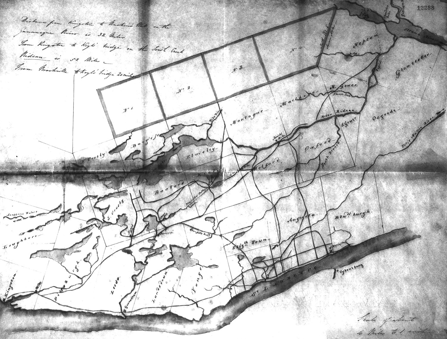
Unknown [Sundries], "Correspondence, March 16 [1816], Quebec. Sir S. [Sidney] Beckwith to [Lt. Gov. Francis] Gore. Transmits two plans of the new settlements and roads in the Rideau River district. pp. 12283-12286A, Enclosed: Plans. pp.12287-12288." Library and Archives Canada, Upper Canada Sundries, RG 5, A1 vol. 27, p.12288.
| This map was drawn prior to March 16, 1816 and shows the roads. The scaling is off but it does appear to show most of the roads from Ottawa to Kingston. They are more sketched than accurately positioned. It's the map closest to the time period of the first Perth settlers. |
|