|
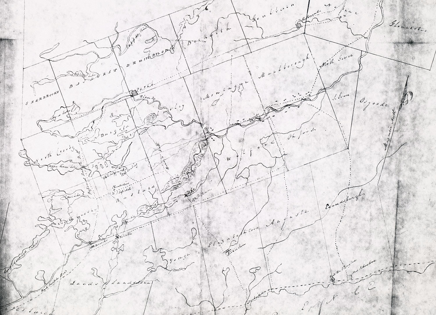
1818 MAP OF THE RIDEAU SETTLEMENT
Dickson, W.R., "Sketch of the Rideau Settlement, with the new townships and others in its vicinity. Copied W.R.D. 1818", 1818, Library and Archives Canada, Manuscript Division, Q(series), 152 Pt. 1, P.27, Microfiche Nos. 2839 & 2840.
| This is a sightly cropped version of an 1818 map. This is the first map on which the name "Old Landing" appears. Roads are also shown. The scaling is off as are the exact road locations, but very useful in that it does show their general direction and clearly separates "Lindsays" and "Old Landing". |
|