
|
|
You are here: Home > Local History > Tay Canal & River > Small 1831 Map> Large 1831 Map of the Lower Tay River |
|
1831 MAP of the LOWER TAY RIVER 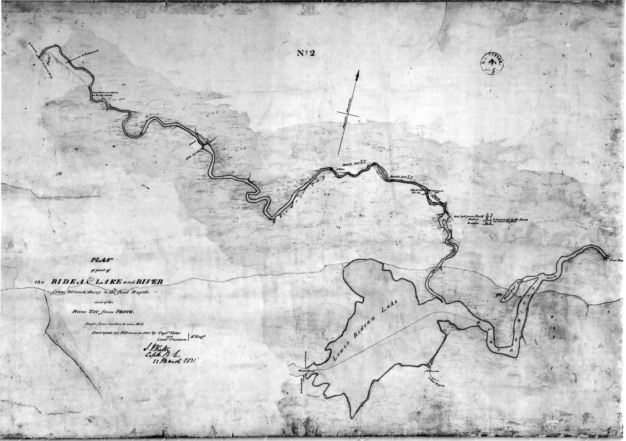 “Plan of part of the Rideau Lake and River from Olivers Ferry to the first Rapids and of the River Tay from Perth”, by J. Victor Captn. R.E.” dated March 23, 1831, Library and Archives Canada, NMC 21969.
|